Mozambique (3): Massengena, Save river crossing, Machasi, Espungabera, Road 216, Chimanimani, Sussundenga, Chimoio, Gorongoza National Park
2011.06.15-18
This is the 3rd of 5 posts to document the Mozambique part of our MozMalZamZim trip.
The first day's journey covered the area from the western side of Mozambique (on the border with Zimbabwe) on the banks of the Save River, the river crossing at Massengena and camping in the bush just past Mapasse. The dotted yellow line tells you that I had to draw a 'track' on the map as Tracks4Africa does not show the roads (which are quite good)!
I used the scale as an icon at Massengena to symbolize that the decision to cross the river needs to carefully weighed up - often river crossings are not feasible here at all, when the level of the river is higher.
Here are the visuals for the first day's journey:
Once we had rested well at IMOFAUNA Camp, we drove 67km to MASSENGENA to buy diesel. Along the way we passed between these two Baobab trees which stood like sentinels next to the road. As you can see the road was quite good.
The petrol station at Massengena was brand new, had diesel and petrol and ghetto blasters which announced its presence with loud music!
The loo, however, was Africa-style.
The children were thrilled with the books we gave them - they even tried to queue more than once!
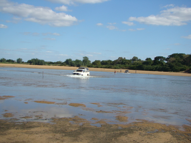
We wove our way through Massengena towards the SAVE RIVER. Crossing the river was easy if you followed Mrad's advice: "Make a 'wave' ahead of your vehicle and then 'push' it across!".
Except if one had a trailer - so Chris ended up winching the Colt across the river and once again through the deep sand on the northerly bank.
Unfortunately, we could not find the MapInfo road going to the northwest from the Save river/Massengena, and had to follow the more easterly road to Mapasse given on Tracks4Africa.
This was the first of many bicycles we saw on this road but nowhere else we saw a mother with four children on her bike!
Beyond Mapasse after a total of 121km we went deep into the veld to bush camp. The area was flat and open and sported a rocket missile (unexploded!) from the war era.
There was plenty of room for us to spread out as it was far from the road.
This grasshopper didn't mind sharing his world with us. He matched the fallen leaves 100%!
The next morning we travelled onwards to the north on Road 412. You can see the road going south to north, then it T-junctions into Road 427 at Machasi and we followed it to the west to the border town Espungabera. We bush camped a few kilometers further.
We passed through several villages which had this type of memorial for those fallen in the war of independence.
Cycling is the main means of transport on this road. A cyclist fell and we helped her reload her bicycle but she was so shaken that we ended up taking her far into the bush towards her homestead - her load was so heavy that Mrad an Eugene could hardly lift it!
At Machaze (Machasi?) we turned west towards Espungabera. This was obviously a main road as most of the villages had shops,
 schools,
The road was badly rutted, but as most people were on foot, this did not bother them.
We passed a beautifully tended vegetable garden, bought some Tzunga (mustard tasting large green leaves)
and were requested to please take a photo of the people working in the garden.
The rolling Chimanimani mountains could be seen in the west.
Every so often we passed a bus stop.
Our road criss-crossed under the ever present Cahora Bassa power lines.
We stopped for lunch next to the brand new LUCITE RIVER Bridge which had been opened on 27 May 2010 - no ferry crossing as predicted by Tracks4Africa!
At DOMBE we turned sharply west towards the Reserva Nacional de Chimanimani.
This was a busy stretch of road.
We passed a large mission station: Missao de Dombe
and saw Mt Binga, the highest peak in Mozambique, in the distance.
Our road continually climbed and gave us spectacular views into the valley we had just crossed - see the power lines on the left side of the picture?
These people were taking their sweet potatoes to the next village and were very pleased when we bought some.
This is the way in which many Mozambicans travel.
We loved the Reserva Nacional de Chimanimani with its magnificent forested areas and we were very pleased when we found NDZOU CAMP - a lovely camp. When the hot water issue has been sorted out, we will return for a longer stay.
After a journey of 128km (5 hours travelling) we spent the evening around the camp fire and enjoyed our two visitors - a cat who found a mother in Wieske,
and a moth who thought he could share Renate's wine!
After a good night's rest, we drove 99km north to get to CHIMOIO via SUSSUNDENGA. The dust from the road gave the plants a surreal look.
We supported the local trade in Sussundenga by buying sugar cane from some children. An adult came to supervise the deal!
From Chimoio we turned east to Inchope and north on the EN1 to cross the Pungwe River. The day's trip ended near Gorongoza National Park. Here the map to show you our route:
Here is what we saw and did. We drove passed schools and various churches - some imposing buildings and others that just epitomized worship - like this one.
Some villages were bustling.
This sign post told us where we were.
Young ones help with daily chores.
Beautiful monolith mountains appeared near Sussundenga and popped up until well beyond Chimoio.
In Chimoio we refuelled.
We headed east towards INCHOPE and there we turned towards the north on the EN6 to cross the PUNGWE RIVER bridge.
The turnoff sign to GORONGOZA NATIONAL PARK is clear.
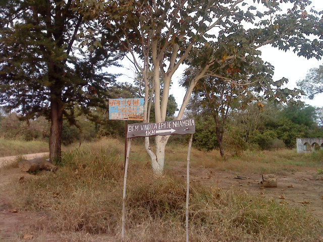
and we found the turnoff to PIET AND RIA VAN ZYL's camp at these signs next to an old ruin - see the ruin on the right hand side of the picture?
The camp is called AVENTURA MA GORONGOZA - an excellent community run camp headed by Sakkie van Zyl with his partner Christiano. With such a convenient kitchen, who wouldn't want to prepare supper? Renate is a great cook.
Our next post (nr 4) tells you about our stay at Gorongoza Adventure Camp.
Either go to the link at the top of this post, OR cllck on the following link to read the next post:
http://mi60mozambique.blogspot.com/2011/01/mozambique-4-gorongoza-adventure-camp.html
Comments will be welcomed!


 schools,


No comments:
Post a Comment